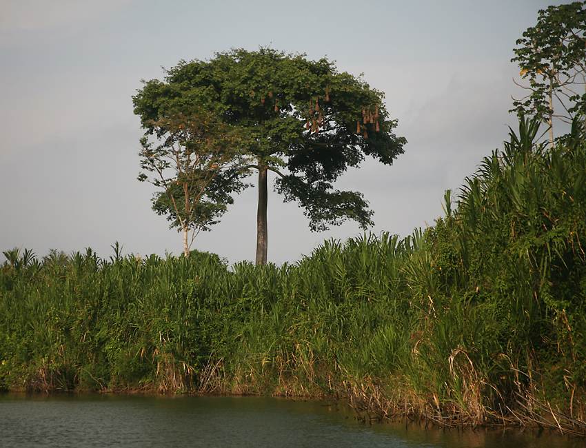
Highlights of Belize (2009)
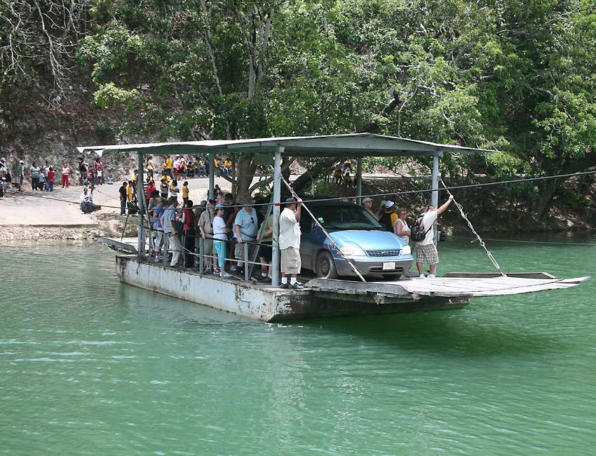
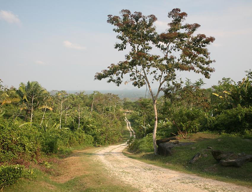
When I visited the small Central American country of Belize in 1999, I spent no time on the mainland. Instead, I stayed in the small town of San Pedro on Ambergris Caye, with an overnight trip to Halfmoon Caye and another overnight trip to Flores in Guatemala so I could visit the spectacular Maya ruins at Tikal. This time I was determined to give Belize at least a bit more time, including an exploration of the mainland. On my month-long trip I spent two and a half weeks in Belize, after spending a week on Mexico's Yucatan Peninsula, and then flying down to Guatemala where I stayed for several days at Tikal itself. I made the mistake of flying from the US straight to Belize, so I had to use a local bus to immediately head from the airport up to Corozal, and then took a taxi over the Mexican border to Chetumal, where I took another bus up to Playa del Carmen and then a ferry over to Cozumel, arriving about 9AM. Since I have a type A personality, I then went diving several times that same day, even though I hadn't had any sleep since leaving the USA! After Tikal I took a bus to Belize City and rented a minivan for 12 days from a taxi driver, because regular rental vehicles were all far too expensive, about $US60 per day not including insurance. I then headed nearly all the way back to Guatemala and spent a night or two outside San Jose Succotz. I was hoping to go to the Maya city at Caracol, but realized the minivan wouldn't be able to negotiate the extremely rough road, and the cost of joining a group for the day trip was beyond my budget. I therefore limited myself to the main local attraction, the Maya ruins at Xunantunich, which are just across the Mopan river from San Jose Succotz. To get there you use this free ferry, which the operator cranks by hand along a cable. |
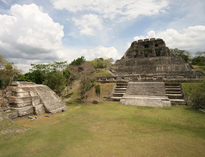
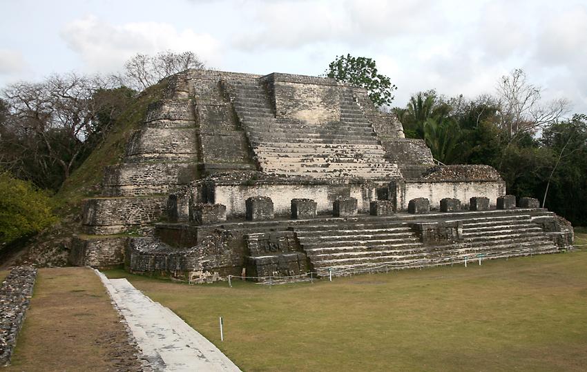
This is the main plaza at Xunantunich, with El Castillo ("the castle") on the right. Almost invariably, the names given by the Spanish invaders to Maya buildings has no relationship to their original function, El Castillo being a temple rather than a defensive structure. It's 40 meters high, making it the second tallest Maya structure in Belize, after the main temple at Caracol. Xunantunich isn't very large or impressive compared to ruins in Mexico and Guatemala, but it's certainly worth visiting, particularly since it's just across from the very nice main road. Proximity to Guatemala is a problem, and the Belize army has a small lookout station on the site with armed soldiers to make sure that sightseers aren't held up by bandits infiltrating across the border from Guatemala. This is also an issue when visiting Caracol, so tourists go there in a convoy with armed escorts. |
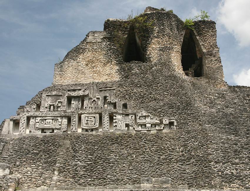
There are large plaster reliefs on both sides of El Castillo. As is so often the case with the Maya, a larger temple was built on top of the original structure, where the reliefs are located. Archaeologists peeled back the newer temple and revealed the reliefs, but what you see here are replicas about a meter above the real thing - plaster is very fragile, so it wouldn't last long if exposed to the elements. Above the reliefs are several rooms built using the "corbelling" technique, with successively higher layers of stonework gradually moving inwards towards the center of the room. The Maya and many other ancient civilizations used this technique because they never worked out how to build round arches or domes, which allow the construction of very large interior spaces. |
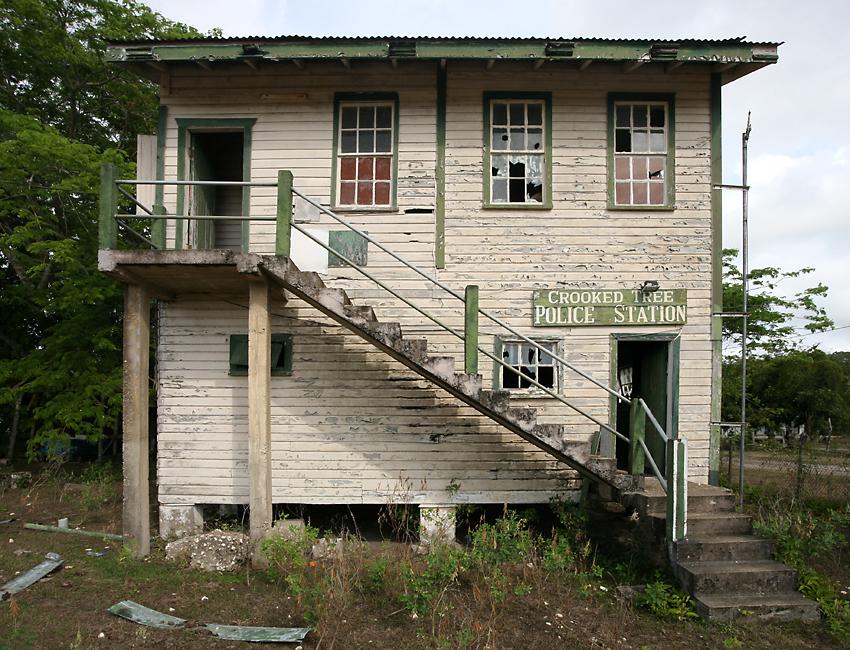
After leaving San Jose Succotz I headed north-east, intending to spend the night at Bermudian Landing so I could spend time in the Community Baboon Sanctuary - "baboon" being the local name for howler monkeys. However I couldn't find the turnoff, so I headed further north to Crooked Tree. On my way to Crooked Tree I stopped off at another Maya site, Altun Ha. It's smaller than Xunantunich, but the Temple of the Masonry Altars shown here is the signature temple of Belize. It's only 16 meters high, but it appears on some Belizean bank notes and also on the label of the national beer brand Belikin, so it's embedded deep into the local psyche! The buildings might not be impressive, but many beautiful objects were recovered from graves at this site, including the largest piece of carved jade ever recovered from any Maya site - a 15 cm high carving of the head of the Maya sun god Kinich Ahau. |
Crooked Tree is world-famous for the water birds which forage in the freshwater lagoons there, and is known locally for growing cashew nuts. There's a low-key resort there for the birdwatchers, but to save money I spent one or two nights at a homestay run by an elderly couple. The birds didn't co-operate too well, so I didn't get as many photos as I wanted, and I decided to head south. |

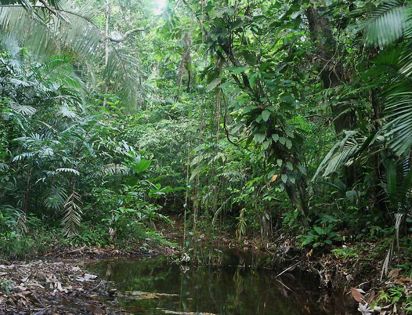
The Hummingbird Highway runs from the capital city, Belmopan, down to Dangriga on the coast. The drive includes some nice stretches of scenery with jungle and several rivers and streams. I was planning to stay at a place in Silk Grass called Crocodile Island, an adventure resort operated by Australians, but it seems they went bust. I headed a short distance south to Hopkins, a small town on the coast, but it didn't seem to be my sort of place, it's more geared towards people wanting a laid-back hippy or stoner atmosphere on the beach, with lots of music and arts. It was already dark, but I drove another 15 or 20 kilometers down to Maya Center, a town beside the southern highway which is populated, as its name implies, by Maya who were relocated here after the nearby Cockscomb Basin Wildlife Sanctuary was created. |
The Cockscomb Basin Wildlife Sanctuary is definitely my sort of place! I spent three full days here at the park headquarters, and I could easily have occupied myself much longer. There's lots of good wildlife here, including birds, mammals like coatimundi and opossums, birds, reptiles and bugs. You can see some of these critters on the Wildlife of Belize page. Although the sanctuary was primarily created as a reserve for jaguars, the chances of seeing one are exceedingly slim, unless you count the painted plaster ones at the interpretive center! Unfortunately the bunkrooms had a bit too much wildlife, in the form of ticks or some other sort of blood-sucking bugs which made quite a mess of my legs. I bought some repellent from one of the rangers who explained the situation to me, but I wish he'd told me about them before I was bitten! |
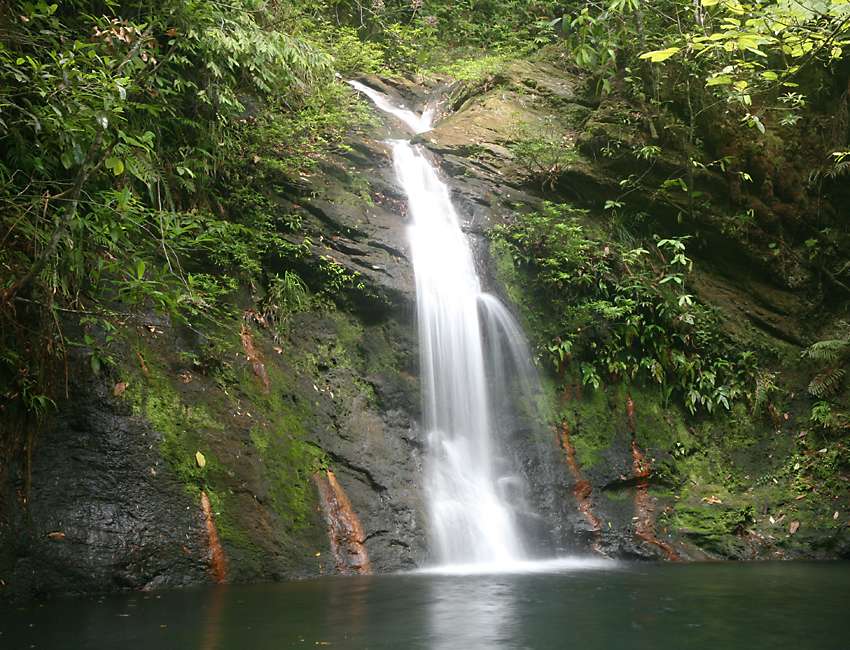
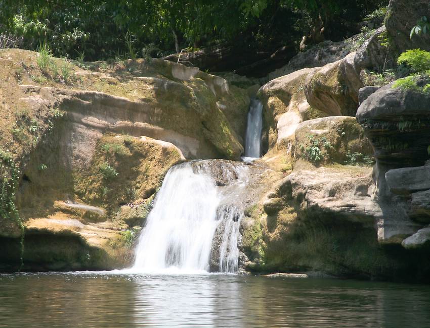
There are several good trails in the park, but when I'm looking for bugs and other interesting wildlife my pace is glacial, so I only covered a small part of what's available. There's a small river you can go tubing on, and several streams feed waterfalls like this one on the Tiger Ferns trail. |

I probably spent as much time out in the jungle at night as I did during the daytime. A lot of wildlife, like some snakes and mammals, are nocturnal, and the same is also true of a lot of bugs. I saw more snakes here than anywhere else in Belize, including the one I was most looking for, the deadly fer-de-lance. It's rightly the most feared snake in Central America, with a highly venomous bite that can do some serious damage. I always look very carefully where I'm walking, even during the daytime, in case I accidentally pass too close to one of these well-camouflaged critters. However I didn't find it on one of the trails, instead it was in the middle of the road when I was driving back at night from dinner in Maya Landing. I couldn't believe my luck, but I had my camera and flash ready on the seat beside me, and got out to take several photos, from what I hoped was a safe distance! Unfortunately I found out that the battery in the minivan I rented was knackered (dead, deceased, no longer entirely functional), and twice the rangers had to use the car battery powering the park's two-way radio to get me started. Luckily, the owner of the place where I'd been staying and eating in Maya Center had a spare battery, which he sold to me.
|
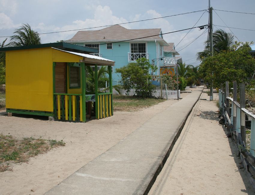
After leaving Cockscomb Basin I went about 50 kilometers south to Placencia, where I stayed for one night. It's at the end of a long peninsula running mostly parallel to the mainland, with a large lagoon in between. This is the famous "sidewalk" which runs north and south some distance inland from the beach, where it's safe from being damaged by the hurricanes which periodically come ashore. |

It's an OK place, but again there isn't an awful lot for me here. I was hoping to do some birdwatching tours, but they were all a bit too expensive for my tastes. |

Many of the wildlife tours from Placencia go down the coast to Monkey River, so I drove down there, crossed the river by boat to Monkey River Town, and went for a tour on the river. This is a very good location to view water birds, and there are quite a few Morelet's crocodiles sunbathing on the riverbanks, small bats on the trees overhanging the river, and also several troops of howler monkeys. |
Here's a view along a stretch of the river. If you look closely you can see baskets hanging from the right-hand side of the very large tree; these belong to oropendola birds, which are famous for the loud calls they make while performing gymnastics from tree branches. The roads in many parts of Belize are very poor, and the minivan was very low-slung, much more suited to American freeways than to unsealed roads with lots of potholes and protruding rocks. I got several flat tires during my trip, and unfortunately when one of these happened on the road leading out of Monkey River, I found out that one of the lug nuts holding the wheel to the van wouldn't budge! There weren't many people on the road, but several people stopped to help, all without success. The area where I got stuck was in the middle of a large orange plantation, and a couple of the workers tried to get the nut off, first with a lug wrench, then by trying to hammer the nut off with a couple of chisels of different sizes! Nothing worked, and eventually they went back to the workshop and got an acetylene torch which they used to melt off the entire threaded stud! Although I lost 3 or 4 hours this way, there was nothing to do but be stoical about the situation, and it was a good introduction to the helpful local people. |
Not many tourists go further south than Placencia or Monkey River, but there are some very worthwhile sights to see in this part of the country. The ruins of two ancient Maya cities are found here, both a short distance from the southern highway. The northernmost is Nim Li Punit, which is a Maya name which translates as "Big Hat". It was only rediscovered in 1976 when oil exploration was happening in the area. It's in a scenic location atop a hill, at the end of the road you see here. I visited late in the day and happened to be there at the same time as a German couple, but the three of us were the only tourists who had been there all day. |

Nim Li Punit has the usual ball court and other structures, but its buildings aren't as large or interesting as those at Xunantunich, Lamanai or Caracol. Instead, Nim Li Punit's main claim to fame is the collection of large stone tablets or stelae which depict the town's rulers and rituals they performed. Four of these stelae are housed in the visitor's center, including the one with the carving of the ruler which gives the site its name. This stela is 10 meters tall, making it the second largest found anywhere in the Maya world. |

All 26 of the stelae found at Nim Li Punit were originally at the Plaza of the Stelae, shown here. There are many stelae at the huge Maya city of Tikal in present-day Guatemala, but they're not commonly seen nowadays in the cities the Maya left in the Yucatan, even very large ones such as Chichen Itza and Uxmal. However, as with many Maya sites, the plaza at Nim Li Punit was laid out so that some of its features align with the annual solstices and equinoxes. |
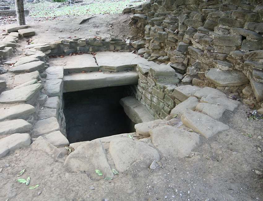
Another unusual feature of Nim Li Punit is the small collection of tombs built into the floor of the Plaza of the Royal Tombs, adjacent to the Plaza of the Stelae. Three tombs have been discovered here, with the remains of eleven people who are all assumed to be members of the ruling family, which is thought to have had their residences on the plaza itself. Various treasures were found in these tombs, including ceramics, carved stone, jade and stingray barbs, which were used in religious blood-letting rituals. |
I also visited the Maya site at Lubaantun, "The Place of Fallen Stones". The structures here are much larger and more impressive than those at nearby Nim Li Punit, but the site lacks interesting features like tombs and stelae. I arrived late in the day and had the entire place to myself, and then pushed on further south to Rio Blanco national park, where I stayed for two or three nights. As its name suggests, the park features a nice river, and several well-marked trails. |
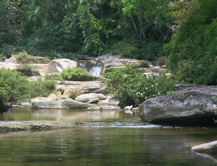
To see wildlife at Rio Blanco I didn't even need to leave the ranger station where I was sleeping! There were several bats roosting in the building, a scorpion with babies under one of the pillows in the bunkroom, and a deadly kissing bug on my insect net after one night's sleep. You can see all of these denizens of the park on the Wildlife of Belize page, together with many other critters I photographed in this place, which was at least as productive as the Cockscomb reserve. This four meter high waterfall is at the center of the trail system. Since it was the dry season when I visited there wasn't much water, but there's a very large and deep swimming hole cut out of the rock below the waterfall. As with many swimming places on the Belize mainland it's inhabited by small fish which seem to enjoy harmlessly nibbling you, like the "doctor fish" which originate in Turkey and are now popular in spas throughout Asia. |
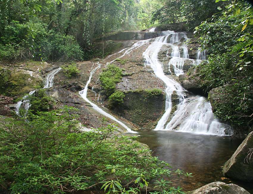
After leaving Rio Blanco I headed back north, stopping on the way at Mayflower Bocawina National Park. This is one of the tiers of Bocawina Falls, which must be quite a sight in the rainy season. Further upstream from this point I came upon a clear-winged butterfly, but in spite of chasing it for 20 minutes I couldn't get a single photograph! |
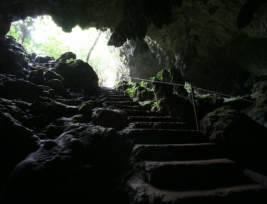
After leaving Rio Blanco I headed back north, stopping on the way at St Herman's Cave, which is near the Blue Hole. The latter shouldn't be confused with the Blue Hole offshore on one of Belize's atolls, instead it's the mouth of a river which emerges from an underground cave only a kilometer or so from St Herman's Cave. There'd been a bit of rain so the Blue Hole looked a bit murky, and I didn't go any further into St Herman's Cave than what you see here. I was mostly interested in the wildlife around the area, so I spent my time looking for interesting critters to photograph. |
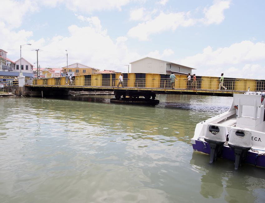
Belize City has quite a reputation for crime, petty and otherwise, so I avoided it completely the last time I visited. This time I went there twice, once at the start of my trip to catch a bus up to Mexico, and again at the end of my time on the mainland, to catch a ferry out to islands along the barrier reef. Both the bus terminal and the downtown area around the ferry terminal are bad places for tourists. It's especially bad that I was at the bus terminal at night, but I survived both experiences with no problems. One of the few tourist sights in Belize City is this swing bridge which crosses Haulover Creek, which was built in 1923. It's manually opened twice a day to let boats through, making it the oldest manual swing bridge in the world which is still operating. |
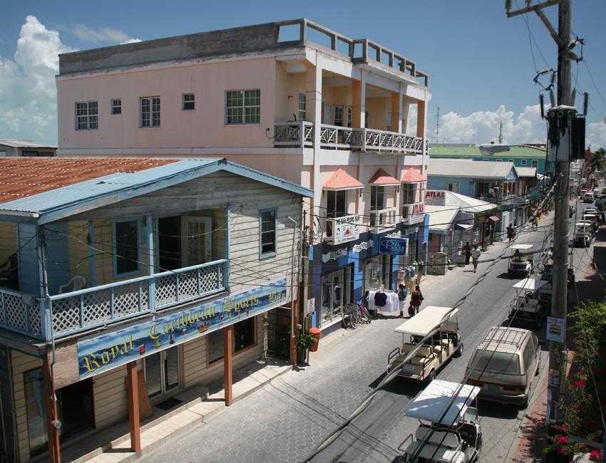
Ambergris Caye is the largest island on the barrier reef, and by far the largest tourist destination in the country. When I visited 10 years ago, Front Street in the town of San Pedro was still made of sand and golf carts were the only transportation. The golf carts are still there, but they're more sophisticated and they've been joined by regular vehicles. However the sand has been replaced by paving stones and the street is now called Barrier Reef Drive. There are only three parallel roads, which used to be called Front Street, Middle Street and (wait for it) Back Street, but I guess the tourism committee didn't think those names were fancy enough, so now they're Barrier Reef Drive, Pescador Drive and Angel Coral Drive. |
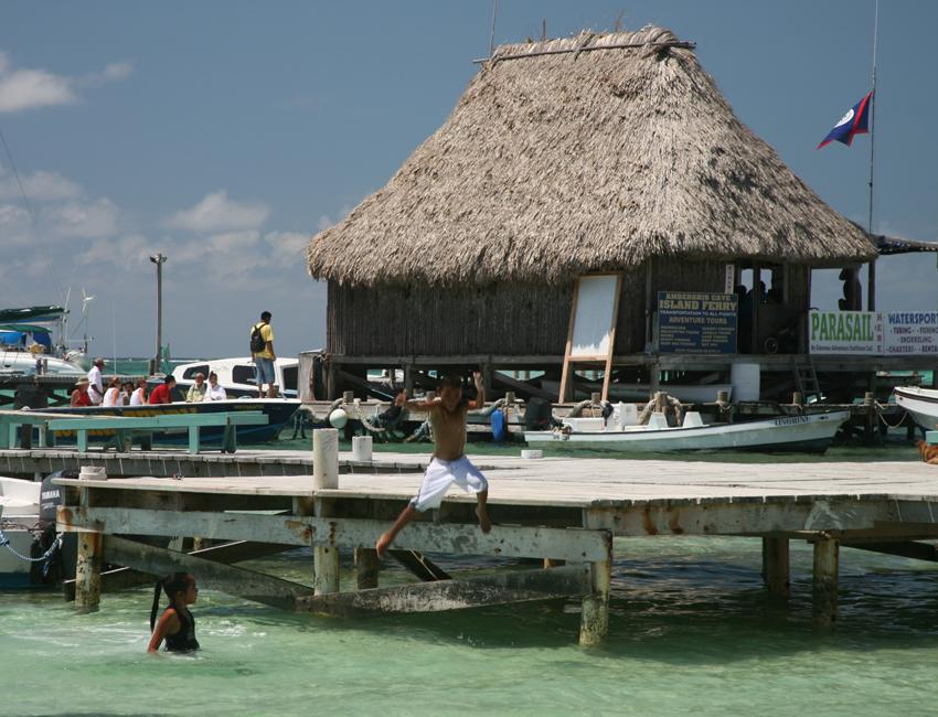
Some local kids enjoy themselves on one of the many piers which jut out towards the barrier reef, which is only about a kilometer offshore. One thing you can say about San Pedro, the beach is good pretty much anywhere you choose to go. |
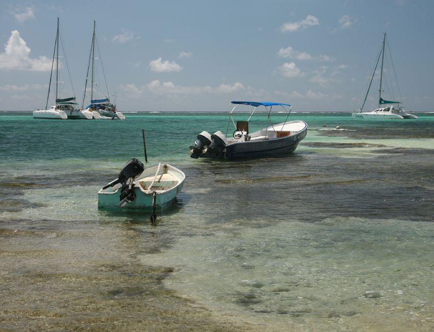
Lying in the sun might have been attractive to me on my first visit, but a bout of melanoma has changed my point of view somewhat. My main interest this time around was scuba diving on the reef, so I booked a package of 16 dives for the five or six days I was there. |