Arizona
It's not clear what the name Arizona means. Some people say that it comes from the Spanish for "arid zone", which is certainly appropriate considering how dry most of the state is. However, others say that it comes from a native American phrase which means "small spring". The Spanish established themselves in southern Arizona in the 1690s, and slowly spread further north. After the United States invaded Mexico and captured Mexico City, the US government laid claim to large parts of what is now the southwest USA, including most of northern Arizona. Eventually Mexico was paid $15 million, and later another $10 million for parts of southern Arizona and New Mexico. However, it wasn't until 1912 that Arizona became a state of the USA, the last of the 48 contiguous states to enter the union. |
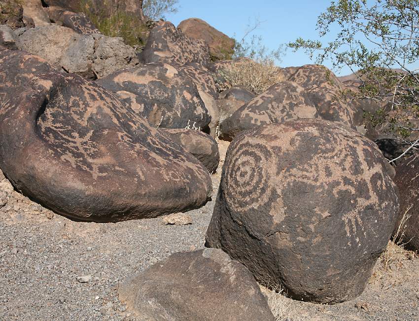
As usual, the native Americans who had lived here for thousands of years had very little say in any of these developments, but it is still possible to see some of their works. As well as ancient villages like the fancifully-named "Montezuma's Castle", there are many rock carvings at sites of spiritual importance. The ones you see here are called the Painted Rock Petroglyphs. They're not visited very much, even though they're located not far off Interstate 8, and only a stone's throw from a parking lot. |
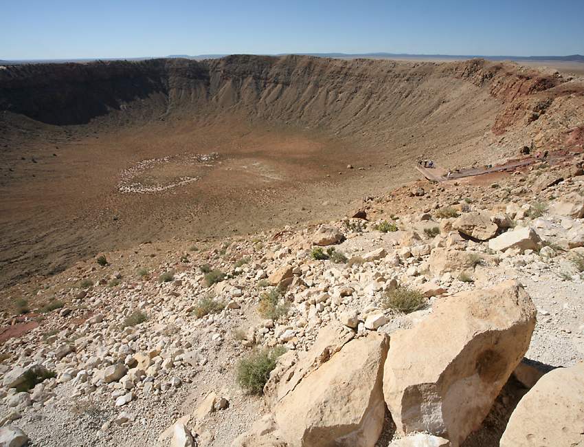
Most people think of Arizona as all desert, but the northern third of the state consists of high elevation plateaus and mountains, with a much cooler climate, allowing pine trees and other vegetation to grow. Still, it's the desert scenery which most people come to see, and Arizona has some truly amazing sights, such as Meteor Crater, which is 4000 feet (1200 meters) in diameter. It's not actually a perfect circle - when the meteorite hit, the geology of the area resulted in a fairly square hole with rounded corners. Although discovered by Europeans in the 1800s, most scientists thought this was a volcanic cone, and it wasn't until 1963 that definitive proof was published showing that the hole was caused by a meteorite. Amazingly, this was the first generally accepted meteor crater on Earth. |
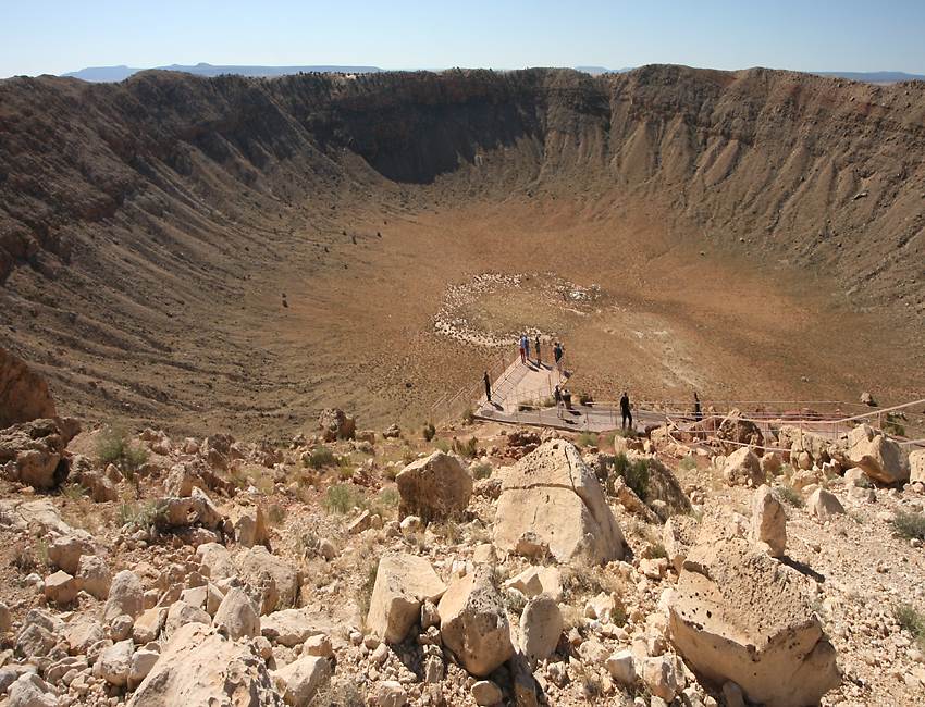
Daniel Barringer was an early proponent of the theory that the crater was formed by a large iron meteorite, so in 1903 he bought the area, and spent 27 years drilling as deep as 1375 feet into the crater floor to find the iron, which he hoped to mine. However, he estimated that the meteor weighed 100 million tons, over 300 times the current estimate of 300 thousand tonnes, and he didn't realize that almost all of the 150 foot wide meteor was vaporized on impact. The impact is thought to have happened about 50,000 years ago, the meteor stiking the ground at 28,500 mph (12.8 kilometers per second). The energy of the explosion was equivalent to 2.5 megatons of TNT, 150 times the size of the Hiroshima atomic bomb. Originally 700 feet deep, the crater has partly filled with debris and is now 570 feet deep, with a rim which rises 150 feet above the surrounding plain. It's still owned by the Barringer family, which operates it as a tourist attraction and advertises it as "the best preserved meteor crater on Earth". It's very conveniently located just six miles south of Interstate 10, and the admission price includes a guided tour onto the crater rim, as well as entrance into a good little museum with displays on the crater and astrogeology. |
Petrified Forest National Park is another world-class tourist site in the area, straddling Interstate 10 about 70 or 80 miles east of Meteor Crater. The park covers 146 square miles. It's dry and often windy, but the elevation of 5400 feet means that it's not as hot as desert areas at lower altitudes, and it's mostly covered in grass rather than cacti and other desert plants. |

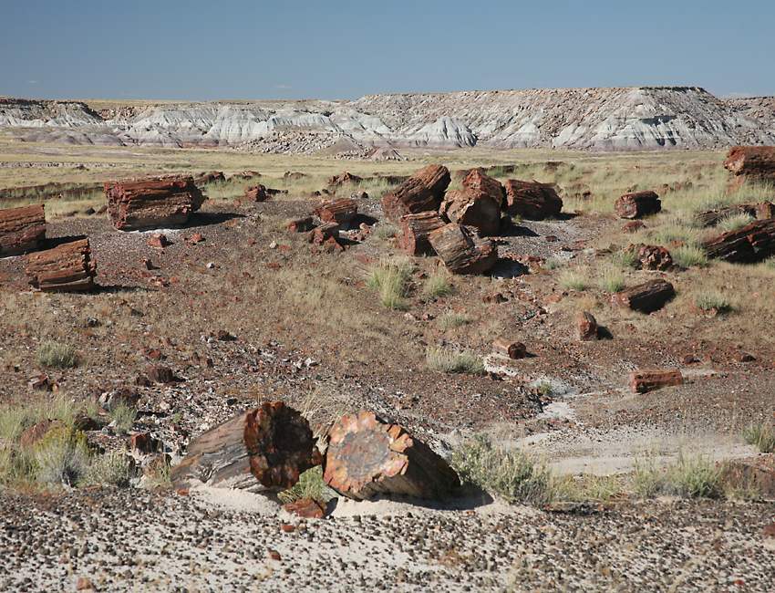
Of course the big attraction here are the petrified trees, which grew here about 225 million years ago when this part of Arizona was at a much lower elevation near the shores of a large sea to the west. As well as the trees, many fossilized animals such as clams, freshwater snails, giant amphibians, crocodile-like reptiles and early dinosaurs have been found here. |
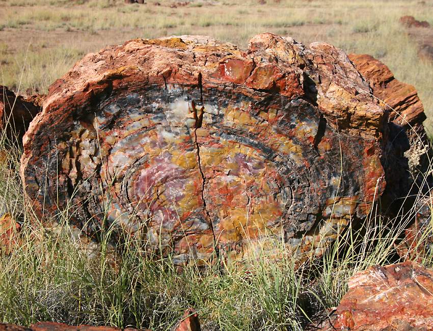
At times volcanic ash was deposited on fallen trees in the forest here, and silica in the ash was dissolved by water and entered the trees, fossilizing them. The silica in the logs crystallized into quartz, but often iron oxide and other minerals were mixed in, producing extraordinarily beautiful kaleidoscopic patterns and colors. |

The petrified trees are often so attractive that a whole industry grew up around hauling them out from where they lay, and cutting them up to make decorative furniture, wall displays, bookends and other items. Theft from the park has always been a problem, and it's estimated that around 12 tons of fossilized wood is stolen each year. |
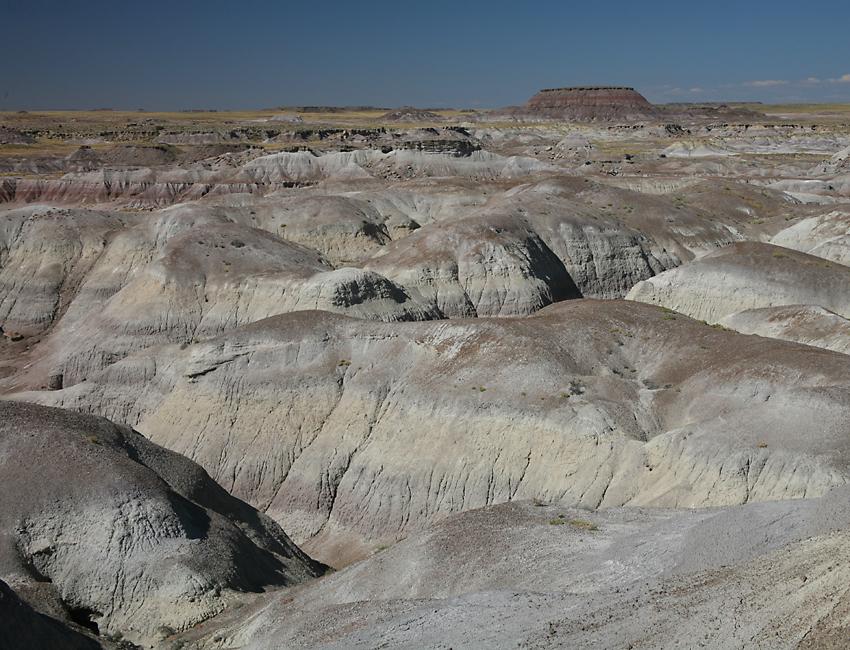
As well as the petrified trees, the park has interesting animals such as pronghorn antelopes, and a variety of badlands geological formations, like these in the "flattops" area. Rain has eroded the badlands into unusual shapes, and the same minerals which created such gorgeous colors in the petrified wood have also added spectacular hues to these structures. |
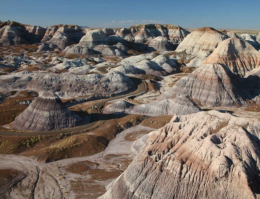
Blue Mesa is perhaps the most unusual and attractive of the formations. It's not as big as it might first seem - note the path running through it, with two people on it! |
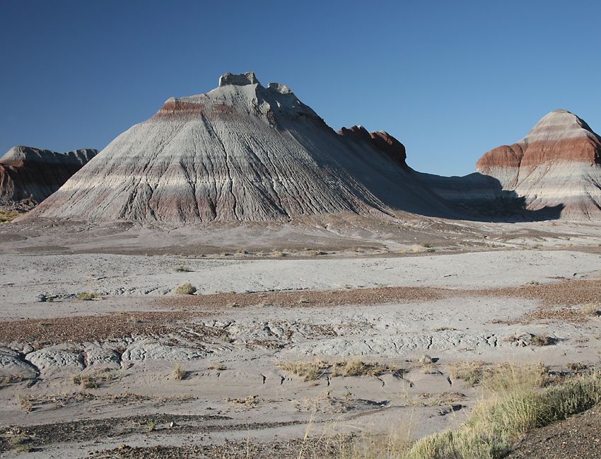
The Tepees are small mudstone hills whose conical shape makes them resemble the Native American tents which gave them their name. |

Very few people come to Arizona because of its hills, but plenty of people come to see its holes! This particular hole is part of the Little Colorado River Gorge. The Little Colorado River drains the area north of the Petrified Forest, and then flows into the main Colorado River. Water isn't the only thing that flows here! In 1979, one of the worst radioactive spills in American history occurred when 100 million gallons of radioactive water drained down the gorge from a waste pond at a uranium mine. |
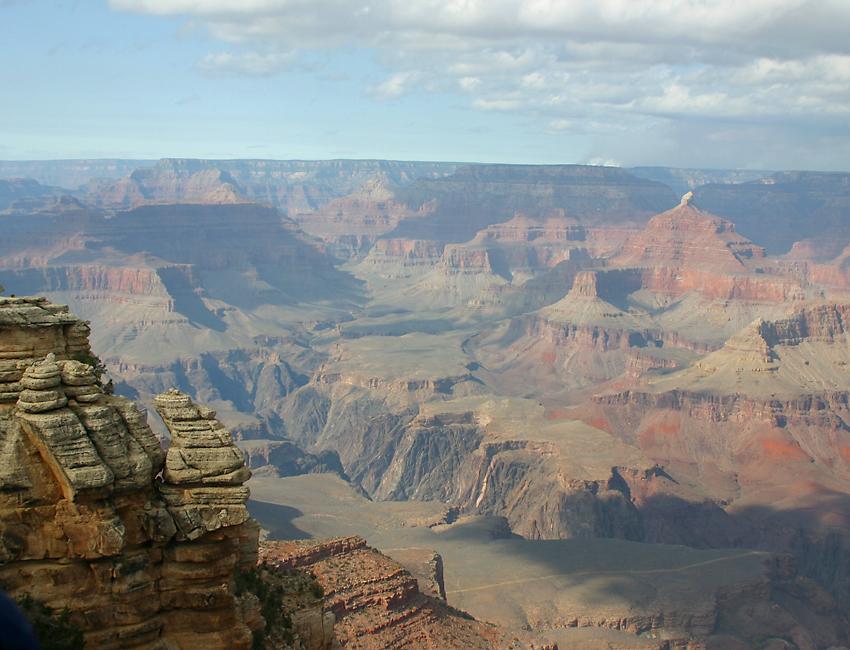
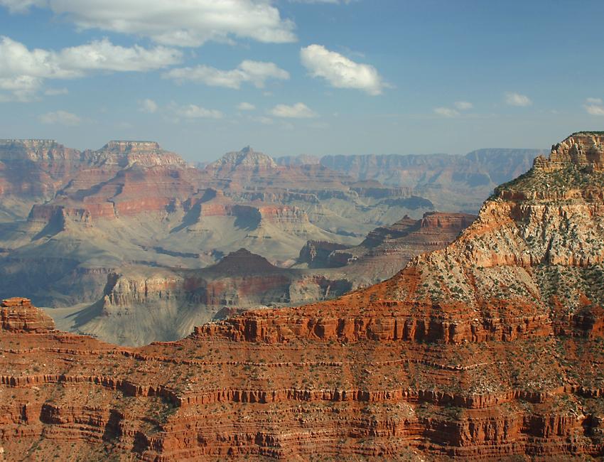
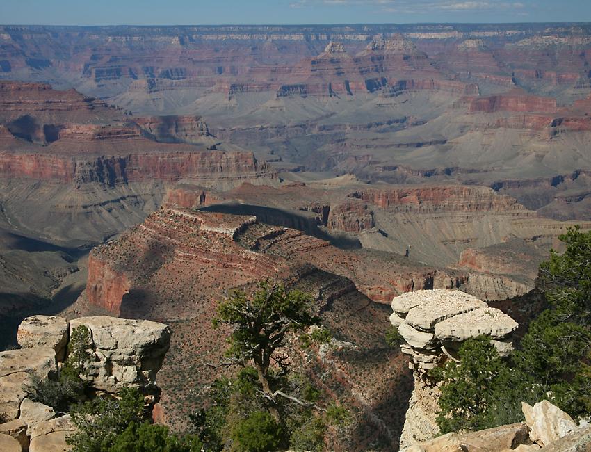
OK, OK, here it is, finally! There's a good reason why Arizona's state nickname is The Grand Canyon State. This gorge carved by the Colorado River is one of the most spectacular sights in the world, and an absolute must-do if you visit the state. This is the view at Mather Point, with many other named peaks, buttes and spires on the far side of the canyon. In the bottom, right-hand corner you can see the Bright Angel Trail as it crosses the plateau before going over the edge into the inner canyon, where the Colorado River is carving the canyon even deeper. |
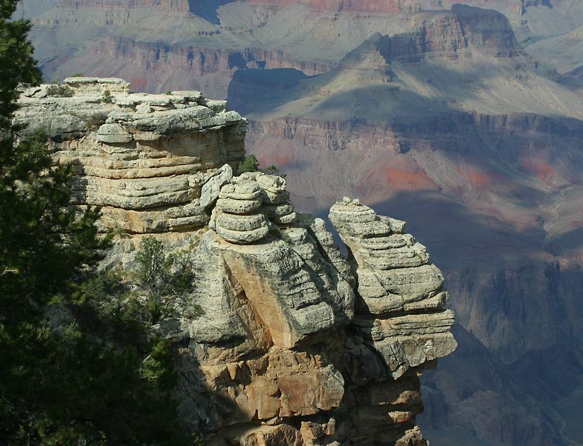
Here's a closeup of Mather Point showing the layers of sedimentary rock which make up this level of the canyon. |
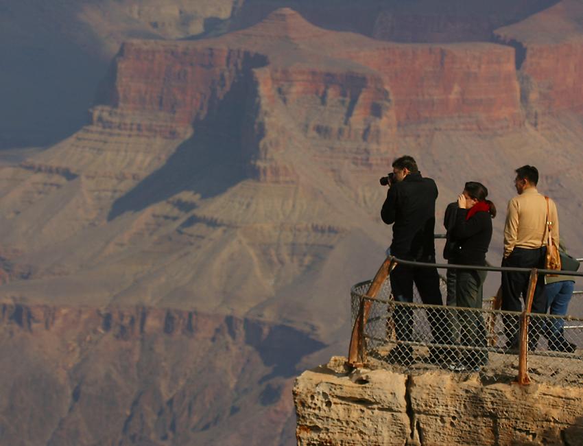
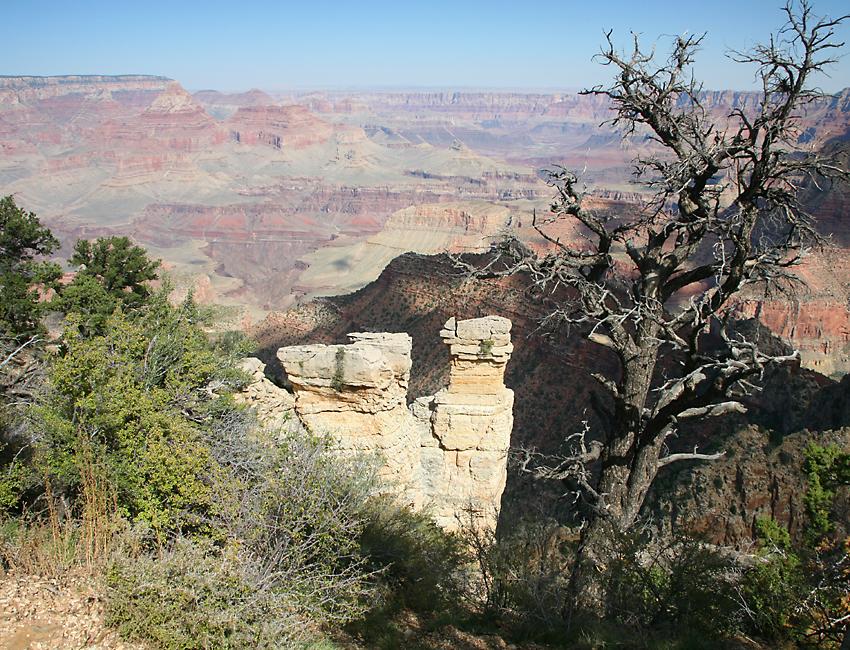
This is the sort of place you can spend a lifetime photographing, because of the constantly changing weather and light conditions. Even if you only visit once, it seems that you can't go wrong, no matter which direction you point your camera in! |
As well as the varying sky and cloudscapes, many vistas in the park consist of layer after layer of formation arrayed from nearby to as far as the eye can see. And of course the layers extend horizontally, too! |
The variety of colors adds another dimension to the scene. |
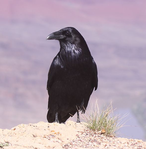
Some of the local animals like this raven are very accustomed to people, and almost invite photographs. If you walk into the canyon or through the woods in the warmer months then it pays to keep an eye out for some of the less friendly inhabitants, such as rattlesnakes. |
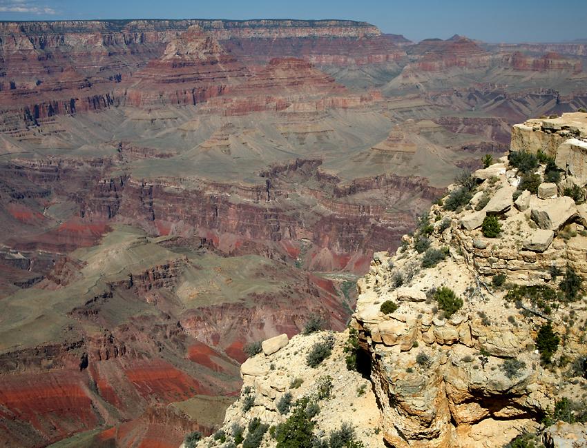
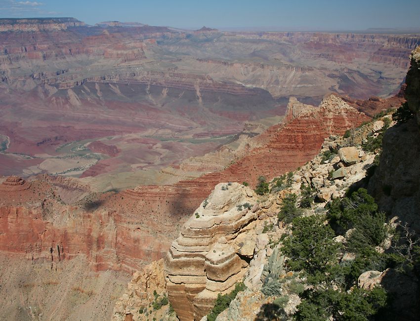
Desert View Drive stretches for about 20 miles along the south rim of the canyon, from the south entrance near Grand Canyon Village to the east entrance at Desert View. About half-way between the two entrances you'll find Grand View, where this photograph was taken. |
There are plenty of other view points along the way! In all, the canyon is 277 miles long and up to 18 miles wide. The Colorado River has been flowing through this area for at least 17 million years, in places carving the rock down to a depth of over a mile. |
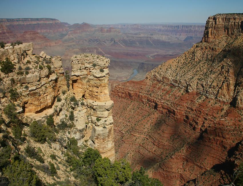
In this photo taken from Lipan Point you can see the Colorado River snaking across the photo from the left-hand side. The river makes a detour around Unkar Delta, bulging out from the left edge of the photo. |
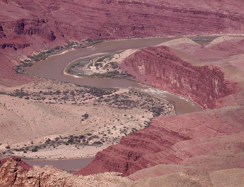
Here's a closeup photo of the delta, created by a small tributary which drains one of the many side canyons. When it hasn't been raining recently, most of these side streams dry up, and indeed the main Colorado River is only a shadow of what it used to be, because so much water has been drained off already to supply cities and agricultural areas. The demands on the river are so great that it no longer reaches the ocean at all. |
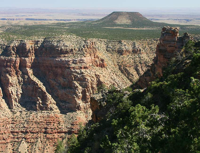
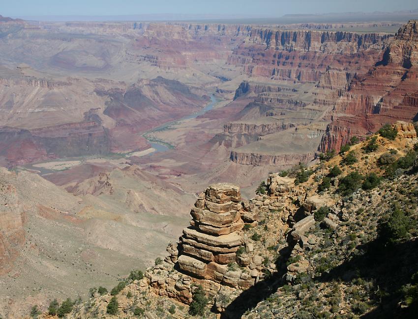
This is Desert View Point, about a mile east of Lipan Point, with the 580 foot high Cedar Mountain in the background. The mountain looks like some weird alien anomaly, like something out of the movie Close Encounters of the Third Kind. Cedar Mountain is composed of a rock formation which has been almost completely eroded away in the surrounding area. |
This scene is looking almost due west from Desert View, with the Colorado River again visible. Desert View is the easternmost viewpoint along the south rim of the canyon. |
In this shot, as in many of the others, you can clearly see the different layers of sedimentary rock which the river has gradually worn down to create the canyon. The canyon is so deep that it provides one of the most revealing geologic columns anywhere, with no fewer than 18 different levels identified so far. The oldest Vishnu basement schist at the bottom of the canyon is believed to be about two billion years old, and the Kaibab formation at the top of the rim dates back to about 230 million years ago. |