Hiroshima Atomic Bomb Museum: Damage to the City
|
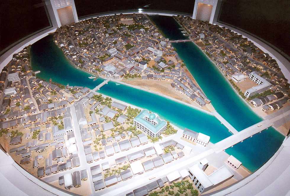
The island in the center of this photograph contained the Sarugaku-cho neighborhood, which is where the Hiroshima Peace Park is now located. The large Industrial Promotion Hall, with its turqoise colored roof is directly across the river from Sarugaku-cho. |
 |
|
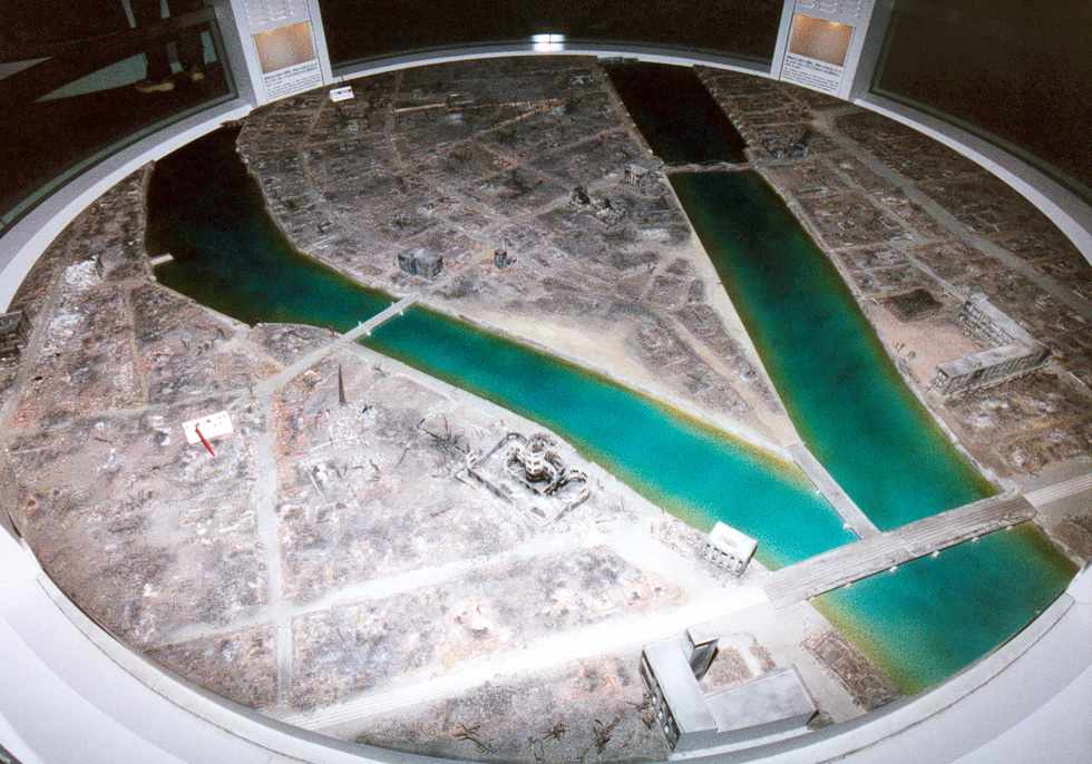
The red marker at the left and center of this display shows the hypocenter of the blast. The T-shaped Aioi River bridge is said to be the aiming point for the bomb, which makes it rather inaccurately dropped. The zero-mile marker for Hiroshima city is much closer, being just to the right of, and on the same riverbank as, the bridge nearest the hypocenter. It's surprising that any structures survived, especially the large building at the bottom of the diorama. |
 |
|
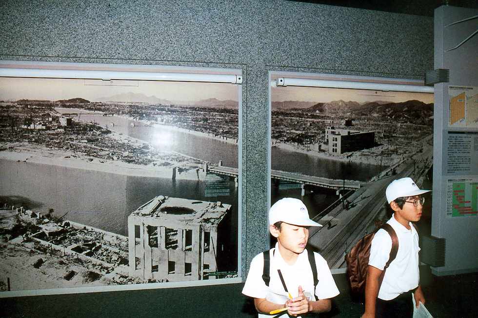
These photographs were taken from the roof of that large building. |
 |
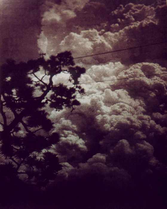 |
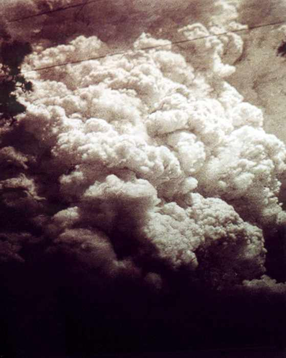
Several photographs were taken from the ground after the blast, by residents of adjacent valleys which were shielded from the direct effects of the explosion. |
 |
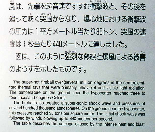 |
Perhaps it's because I'm an engineer that the thing which affected me most is this description of the force of the explosion. |